
Image: Roanoke Island
Size of this preview: 609 × 600 pixels. Other resolutions: 244 × 240 pixels | 900 × 886 pixels.
Original image (900 × 886 pixels, file size: 73 KB, MIME type: image/gif)
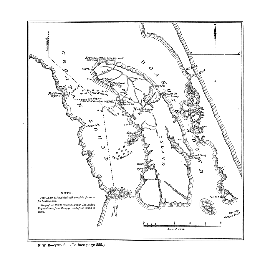
Description: Source: Official records of the Union and Confederate Navies in the War of the Rebellion, Ser. I, vol. 6, p. 554a. Comment: Map of Roanoke Island and Croatan Sound, showing the Confederate forts and the dispositions of the Federal and Confederate fleets, 7 February 1862.
Title: Roanoke Island
Credit: Official records of the Union and Confederate Navies in the War of the Rebellion, Ser. I, vol. 6, p. 554a. Transferred from en.wikipedia to Commons.
Usage Terms: Public domain
License: Public domain
Attribution Required?: No
Image usage
The following page links to this image:

All content from Kiddle encyclopedia articles (including the article images and facts) can be freely used under Attribution-ShareAlike license, unless stated otherwise.