
Image: Ringgold Gap Battlefield Georgia
Size of this preview: 457 × 599 pixels. Other resolutions: 183 × 240 pixels | 1,540 × 2,020 pixels.
Original image (1,540 × 2,020 pixels, file size: 949 KB, MIME type: image/jpeg)
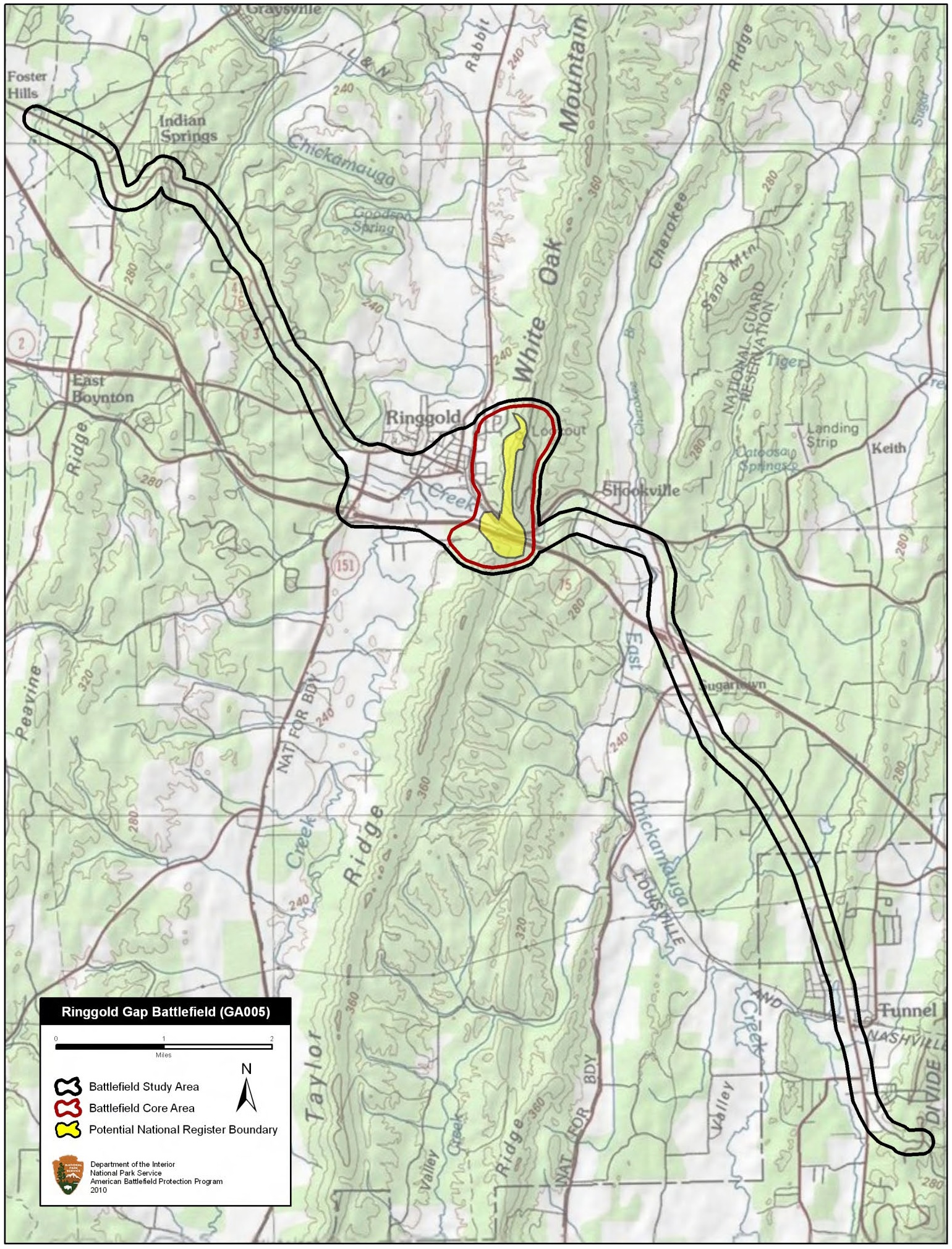
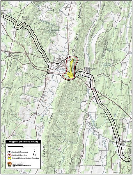
Description: Map of battlefield core and study areas. The Study Area was expanded to show the Federal pursuit of the Army of Tennessee from Chattanooga. It also includes the route taken by the Confederate wagon train southwest toward Dalton. Cleburne’s stand at Ringgold Gap insured that the vital wagons remained in Confederate control.
Title: Ringgold Gap Battlefield Georgia
Credit: National Park Service
Author: American Battlefield Protection Program
Usage Terms: Public domain
License: Public domain
Attribution Required?: No
Image usage
The following page links to this image:

All content from Kiddle encyclopedia articles (including the article images and facts) can be freely used under Attribution-ShareAlike license, unless stated otherwise.