
Image: Rim Village map, Comfort Station -4
No higher resolution available.
Rim_Village_map,_Comfort_Station_-4.JPG (520 × 281 pixels, file size: 54 KB, MIME type: image/jpeg)
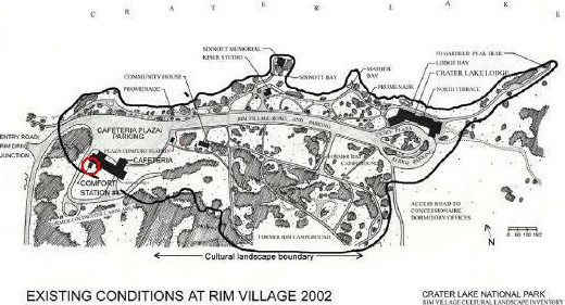
Description: Rim Village (Crater Lake National Park) map showing location of Comfort Station #4; building is listed on National Register of Historic Places as "Comfort Station No. 72" (NRHP #88002625)
Title: Rim Village map, Comfort Station -4
Credit: http://www.craterlakeinstitute.com/online-library/rim-village-cli/site.htm
Author: National Park Service
Permission: Public Domain
Usage Terms: Public domain
License: Public domain
Attribution Required?: No
Image usage
The following page links to this image:

All content from Kiddle encyclopedia articles (including the article images and facts) can be freely used under Attribution-ShareAlike license, unless stated otherwise.