
Image: Riefkohl map

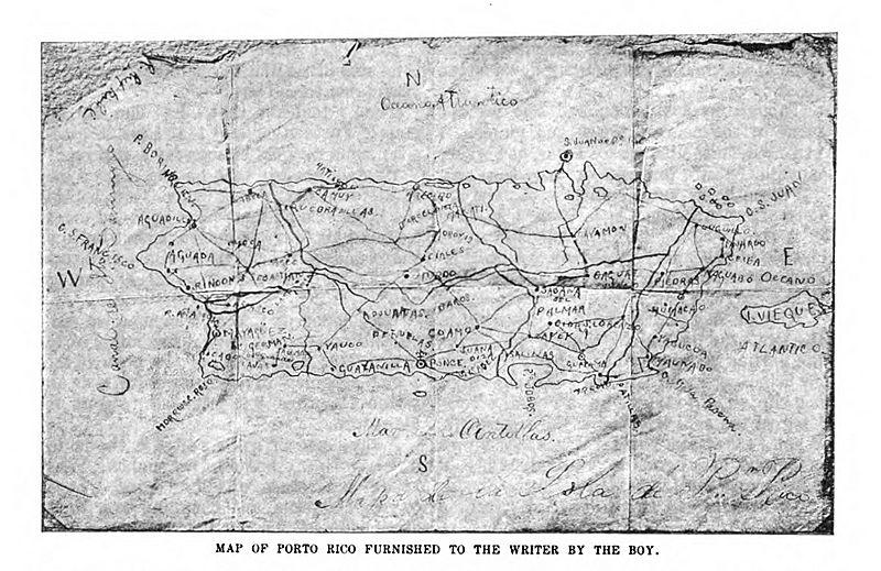
Description: This is a map of Puerto Rico drawn by Rudolph W. Riefkohl in 1898 and published in "Alone in Puerto Rico, by Edwin Emerson Jr., Century Magazine, Vol. 56, Issue 5, pp. 673, in September 1898 twenty five years before the implementation of copyright laws and therefore PD. Source http://digital.library.cornell.edu/cgi/t/text/pageviewer-idx?c=cent;cc=cent;rgn=full%20text;idno=cent0056-5;didno=cent0056-5;view=image;seq=684;node=cent0056-5%3A6;page=root;size=s;frm=frameset Further reference: http://home.coqui.net/sarrasin/Espias.html
Title: Riefkohl map
Credit: http://digital.library.cornell.edu/cgi/t/text/pageviewer-idx?c=cent;cc=cent;rgn=full%20text;idno=cent0056-5;didno=cent0056-5;view=image;seq=684;node=cent0056-5%3A6;page=root;size=s;frm=frameset
Author: Rudolph W. Riefkohl
Usage Terms: Public domain
License: Public domain
Attribution Required?: No
Image usage
The following page links to this image:
