
Image: RichelieuValleyMontrealThreeRivers1777
Size of this preview: 386 × 599 pixels. Other resolutions: 155 × 240 pixels | 562 × 872 pixels.
Original image (562 × 872 pixels, file size: 403 KB, MIME type: image/png)
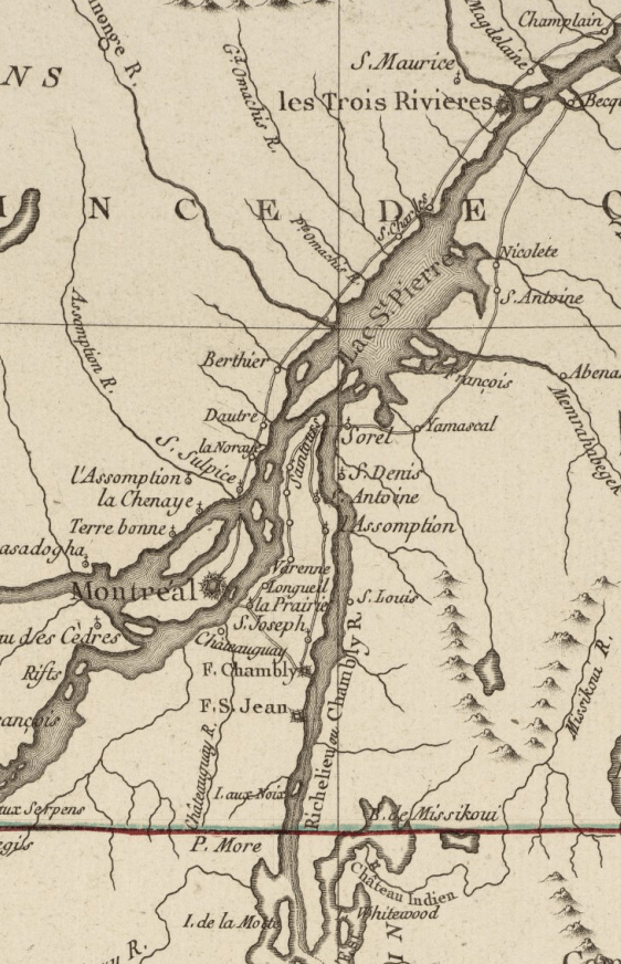
Description: This is a detail from the source map, whose caption reads Carte du théatre de la guerre entre les Angais et les Américans (Map of the theater of war between the English and the Americans). This detail shows the valley of the Richelieu River, as well as the Saint Lawrence River from above Montreal to Trois-Rivières. The map includes
Title: RichelieuValleyMontrealThreeRivers1777
Credit: From the Boston Public Library Digital Maps Collection Call Number: Call Number: G3711.S3 1777 .B75 URL at time of upload: http://maps.bpl.org/details_10101/
Author: Louis Brion de la Tour
Usage Terms: Public domain
License: Public domain
Attribution Required?: No
Image usage
The following page links to this image:

All content from Kiddle encyclopedia articles (including the article images and facts) can be freely used under Attribution-ShareAlike license, unless stated otherwise.