
Image: Richardson's Route Map
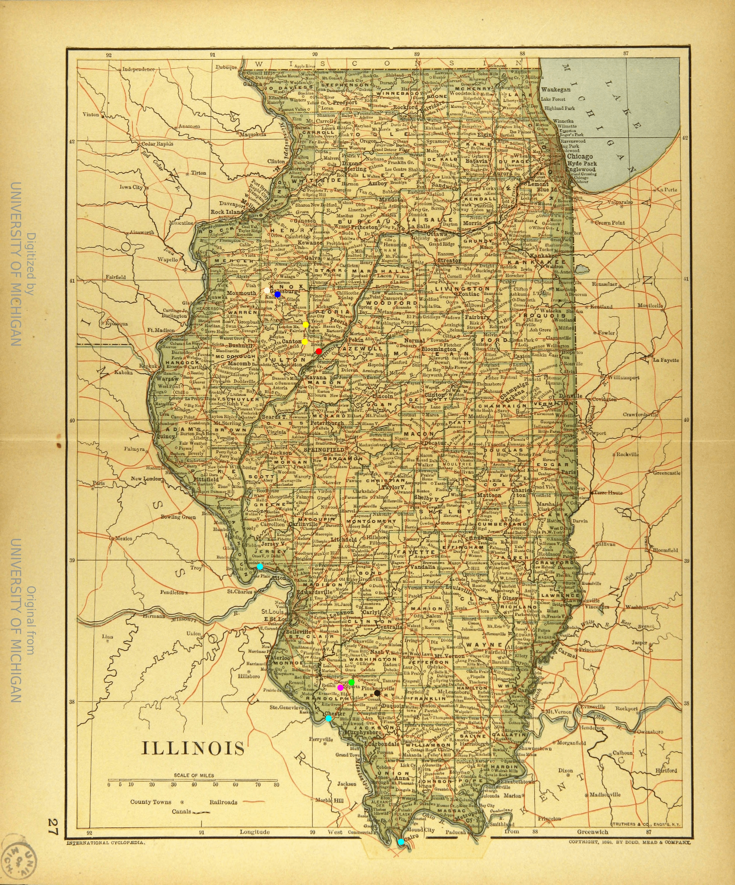
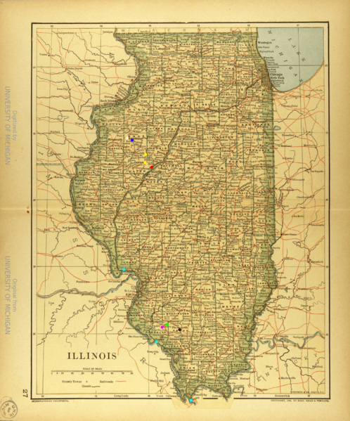
Description: Pink: Borders’ Farm Green: Hayes’ Farm Light Blue: The possible sites where Richardson’s group got on a steamship so that they could escape via the Mississippi and Illinois rivers: Cairo, Chester Landing, or Grafton, near Alton Red: Copperas Creek, where Richardson’s group left the steamship Yellow: Canton and Farmington, where Richardson’s group were by Sep. 5th Blue: Knoxville, where Richardson’s group was held in jail, then worked Black: Pinckneyville, the site of Borders v Hayes White: Galesburg, where Richardson lived after escaping slavery
Title: Richardson's Route Map
Credit: Own work
Author: Athko
Usage Terms: Creative Commons Attribution-Share Alike 4.0
License: CC BY-SA 4.0
License Link: https://creativecommons.org/licenses/by-sa/4.0
Attribution Required?: Yes
Image usage
The following page links to this image:
