
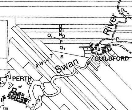
Image: Ribbon grants of the Bayswater area, Swan River Colony
No higher resolution available.
Ribbon_grants_of_the_Bayswater_area,_Swan_River_Colony.png (429 × 357 pixels, file size: 78 KB, MIME type: image/png)
Description: Map of ribbon grants in the Bayswater area of the Swan River Colony created by John Arrowsmith in 1839 using survey data by John Septimus Roe. This map is cropped from a restored version that appears in Changes they've seen : the city and people of Bayswater 1827-2013, by Catherine May.
Title: Ribbon grants of the Bayswater area, Swan River Colony
Credit: May, Catherine (2013). Changes they've seen : the city and people of Bayswater 1827-2013.
Author: John Arrowsmith, using survey data by John Septimus Roe.
Usage Terms: Public domain
License: Public domain
Attribution Required?: No
Image usage
The following 3 pages link to this image:

All content from Kiddle encyclopedia articles (including the article images and facts) can be freely used under Attribution-ShareAlike license, unless stated otherwise.