
Image: Rhymney Valley - geograph.org.uk - 1049228
No higher resolution available.
Rhymney_Valley_-_geograph.org.uk_-_1049228.jpg (640 × 480 pixels, file size: 134 KB, MIME type: image/jpeg)
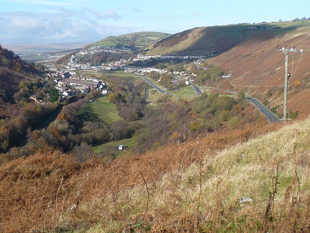
Description: Rhymney Valley The view northwards up the Rhymney Valley. Communities visible are Cwmsyfiog, Elliot's Town, Phillip's Town and New Tredegar on the east side of the valley. On the west side are Brithdir and Tirphil. In the distance is Abertysswg.
Title: Rhymney Valley - geograph.org.uk - 1049228
Credit: From geograph.org.uk
Author: Robin Drayton
Usage Terms: Creative Commons Attribution-Share Alike 2.0
License: CC BY-SA 2.0
License Link: https://creativecommons.org/licenses/by-sa/2.0
Attribution Required?: Yes
Image usage
The following 2 pages link to this image:

All content from Kiddle encyclopedia articles (including the article images and facts) can be freely used under Attribution-ShareAlike license, unless stated otherwise.