
Image: Revised Map of the Afsharid Empire
No higher resolution available.
Revised_Map_of_the_Afsharid_Empire.png (620 × 427 pixels, file size: 13 KB, MIME type: image/png)
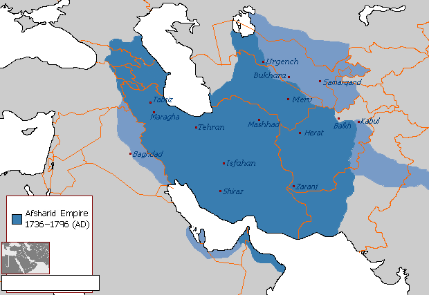
Description: A comprehensive map of the Afsharid Empire at its zenith between 1741 - 1743 (dark blue), with territories under Afsharid control but not officially annexed, over time (light blue). Based primarily on Emanuel Bowen's 1747 map, cross-referenced with the territorial descriptions listed in the Treaties of Constantinople and Kerden, as well as the territorial exchanges west of the Indus following the Afsharid-Mughal War.
Title: Revised Map of the Afsharid Empire
Credit: Own work
Author: Cannon223
Usage Terms: Creative Commons Attribution-Share Alike 4.0
License: CC BY-SA 4.0
License Link: https://creativecommons.org/licenses/by-sa/4.0
Attribution Required?: Yes
Image usage
The following 2 pages link to this image:

All content from Kiddle encyclopedia articles (including the article images and facts) can be freely used under Attribution-ShareAlike license, unless stated otherwise.