
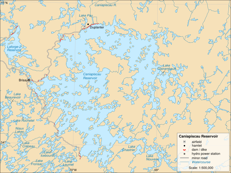
Image: Reservoir-caniapiscau-en

Description: English version of a map of the Caniapiscau reservoir, in northern Quebec. Lambert conformal conic projection, NAD83, scale: 1:500,000.
Title: Reservoir-caniapiscau-en
Credit: This file was derived from: Reservoir-caniapiscau-fr.svg:
Author: Reservoir-caniapiscau-fr.svg / Bouchecl derivative work: Bouchecl Data sources: Vector data : Ministère des Ressources naturelles et de la Faune du Québec. BDGA 1m. Retrieved on 2012-07-17. (must be cited). Dams and dikes: Ressources naturelles Canada. CanVEC. GeoGratis. Retrieved on 2012-07-17. (must be cited). Topography: NASA / USGS. Shuttle Radar Topography Mission (SRTM30). Retrieved on 2012-07-17. (public domain).
Usage Terms: Creative Commons Attribution-Share Alike 3.0
License: CC BY-SA 3.0
License Link: https://creativecommons.org/licenses/by-sa/3.0
Attribution Required?: Yes
Image usage
The following page links to this image:
