
Image: RegulusIgnicapillaIUCN

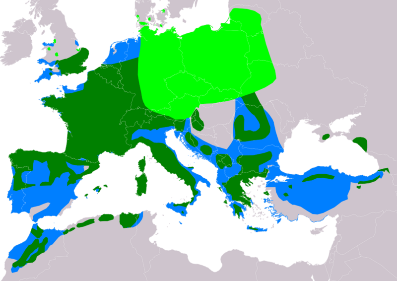
Description: Distribution map of Common Firecrest Regulus ignicapilla according to IUCN version 2021.3 (Compiled by: BirdLife International and Handbook of the Birds of the World (2016) 2016. ); key: Legend: Extant, breeding (#00FF00), Extant, resident (#008000), Extant, non-breeding (#007FFF)
Title: RegulusIgnicapillaIUCN
Credit: Own work using: Natural Earth. Free vector and raster map data @ naturalearthdata.com. Range map from BirdLife International. 2016. Regulus ignicapilla. The IUCN Red List of Threatened Species 2016: e.T22735002A87781502. https://dx.doi.org/10.2305/IUCN.UK.2016-3.RLTS.T22735002A87781502.en. Accessed on 25 March 2022 as visual indicator of distribution.
Author: SanoAK: Alexander Kürthy
Usage Terms: Creative Commons Attribution-Share Alike 3.0
License: CC BY-SA 3.0
License Link: https://creativecommons.org/licenses/by-sa/3.0
Attribution Required?: Yes
Image usage
The following page links to this image:
