
Image: Rednorthfloodwaymap
No higher resolution available.
Rednorthfloodwaymap.png (500 × 500 pixels, file size: 68 KB, MIME type: image/png)
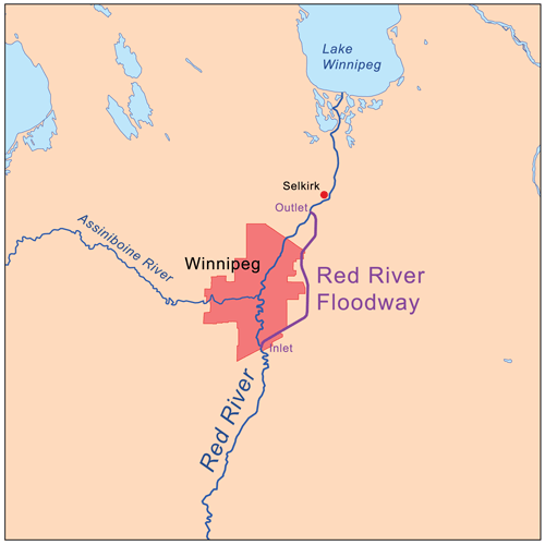
Description: This is a map of the Red River Floodway using Digital Chart of the World data. National Resources Canada map <a href="http://gsc.nrcan.gc.ca/floods/redriver/geological_e.php">here</a> used as reference.
Title: Rednorthfloodwaymap
Credit: Own work
Author: Kmusser
Usage Terms: Creative Commons Attribution 2.5
License: CC BY 2.5
License Link: https://creativecommons.org/licenses/by/2.5
Attribution Required?: Yes
Image usage
The following 3 pages link to this image:

All content from Kiddle encyclopedia articles (including the article images and facts) can be freely used under Attribution-ShareAlike license, unless stated otherwise.