
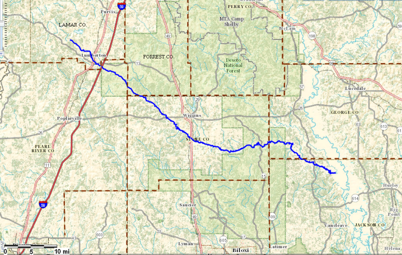
Image: Red Creek Location Map

Description: Location of Red Creek (bold blue line) within six southeastern counties (Lamar, Pearl River, Forrest, Stone, George, and Jackson) of Mississippi, USA.
Title: Red Creek Location Map
Credit: http://viewer.nationalmap.gov/viewer/
Author: USGS
Permission: Map services and data downloaded from The National Map are in the public domain. There are no restrictions, however USGS requests that the following acknowledgment statement of the originating agency be included in products and data derived from our map services when citing, copying, or reprinting: "Map services and data available from U.S. Geological Survey, National Geospatial Program".
Usage Terms: Public domain
License: Public domain
Attribution Required?: No
Image usage
The following page links to this image:
