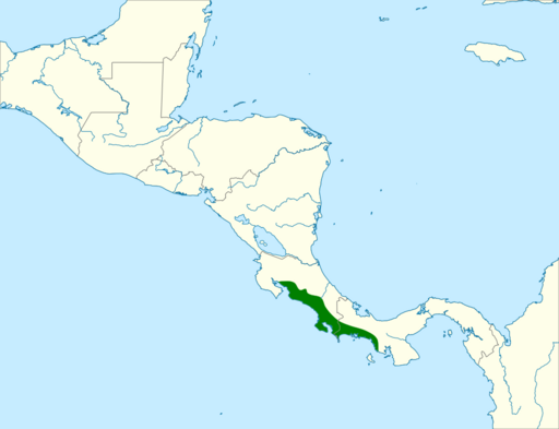
Image: Ramphocelus costaricensis map

Size of this PNG preview of this SVG file: 512 × 393 pixels. Other resolution: 313 × 240 pixels.
Original image (SVG file, nominally 512 × 393 pixels, file size: 336 KB)
Description: Range map of Cherrie's tanager (Ramphocelus passerinii costaricensis or Ramphocelus costaricensis).
Title: Ramphocelus costaricensis map
Credit: Adapted from: Birds of Central America : Belize, Guatemala, Honduras, El Salvador, Nicaragua, Costa Rica, and Panama. Andrew C. Vallely and Dale Dyer. Princeton, New Jersey : Princeton University Press, 2018. ISBN:9780691184159
Author: Cephas
Usage Terms: Creative Commons Attribution-Share Alike 4.0
License: CC BY-SA 4.0
License Link: https://creativecommons.org/licenses/by-sa/4.0
Attribution Required?: Yes
Image usage
The following page links to this image:

All content from Kiddle encyclopedia articles (including the article images and facts) can be freely used under Attribution-ShareAlike license, unless stated otherwise.
