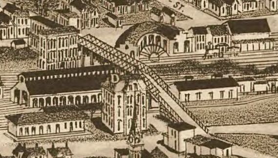
Image: Railroad-yard-knoxville-1886-tn1
Description: The railroad yard at the north end of Gay Street, as it appeared on an 1886 map of Knoxville, Tennessee, USA. The building labelled "D" was the depot and offices for the East Tennessee, Virginia & Georgia Railroad (later part of the Southern Railway). The truss bridge over the tracks has been replaced by the Gay Street Viaduct. The buildings in the upper right have been replaced by the Southern Railway Terminal. Cropped from map entitled, "Knoxville, Tennessee, County Seat of Knox County."
Title: Railroad-yard-knoxville-1886-tn1
Credit: This map is available from the United States Library of Congress's Geography & Map Division under the digital ID g3964k.pm009000. This tag does not indicate the copyright status of the attached work. A normal copyright tag is still required. See Commons:Licensing for more information. العربية | čeština | Deutsch | English | español | فارسی | suomi | français | magyar | italiano | македонски | മലയാളം | Nederlands | polski | português | русский | slovenčina | slovenščina | Türkçe | українська | 中文 | 中文(简体) | 中文(繁體) | +/−
Author: H. Wellge (drawing); Beck & Pauli (lithograph)
Usage Terms: Public domain
License: Public domain
Attribution Required?: No
Image usage
The following page links to this image:


