
Image: Race to the Sea 1914
Size of this preview: 493 × 600 pixels. Other resolutions: 197 × 240 pixels | 740 × 900 pixels.
Original image (740 × 900 pixels, file size: 71 KB, MIME type: image/png)
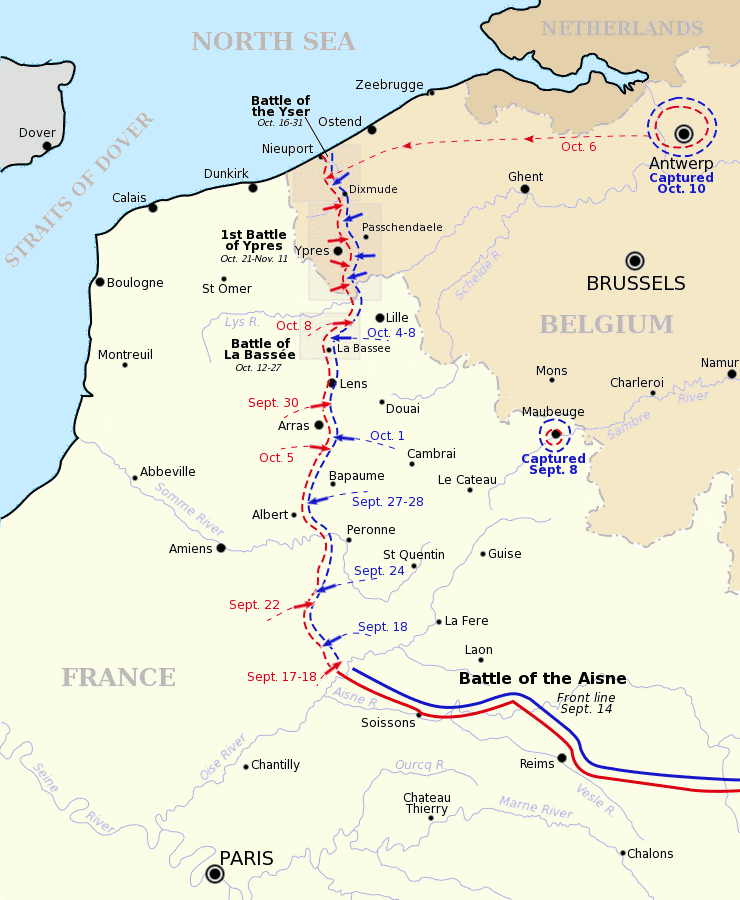
Description: Map showing the course of the "Race to the Sea" during 1914 following the Battle of the Aisne. Allied front line and movement is shown in red, German front line and movement shown in blue. Three of the battles that occurred during or after the "race" are shown boxed. Based on a map from A Short Military History of World War I - Atlas, edited by T. Dodson Stamps and Vincent J. Esposito, 1950.
Title: Race to the Sea 1914
Credit: Gsl Originally uploaded to EN Wikipedia 8 August 2004
Author: Gsl
Usage Terms: Public domain
License: Public domain
Attribution Required?: No
Image usage
The following 3 pages link to this image:

All content from Kiddle encyclopedia articles (including the article images and facts) can be freely used under Attribution-ShareAlike license, unless stated otherwise.