
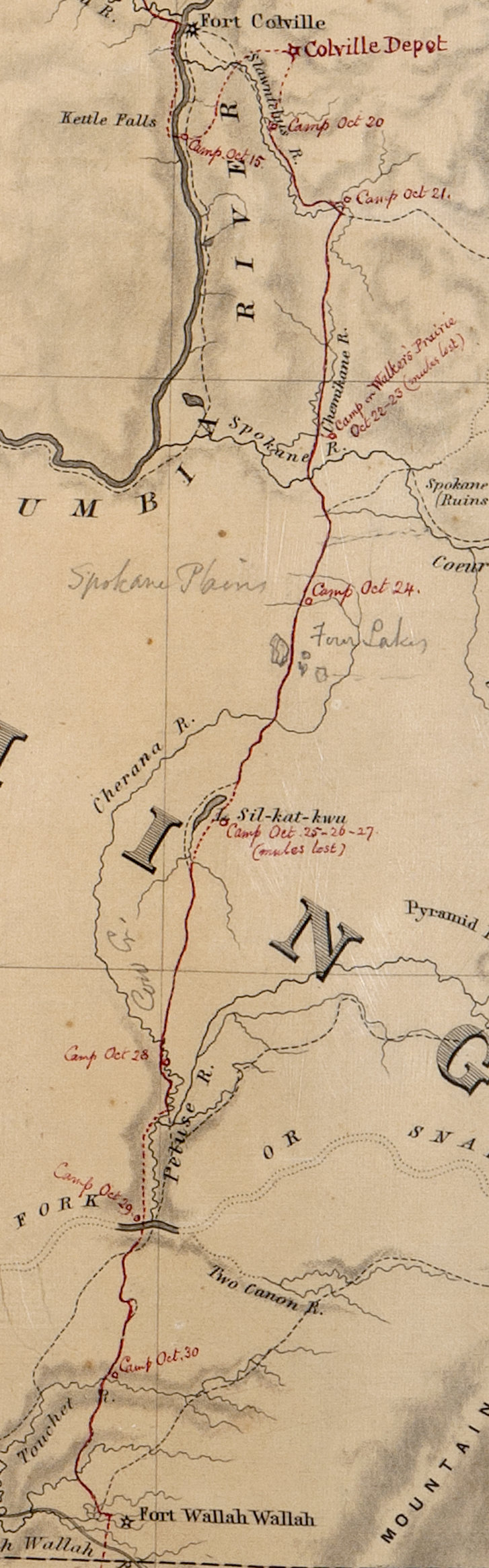
Image: RG77-CWMF-W52-BoundCommRoute
Size of this preview: 187 × 600 pixels. Other resolutions: 75 × 240 pixels | 727 × 2,331 pixels.
Original image (727 × 2,331 pixels, file size: 378 KB, MIME type: image/jpeg)
Description: Portion of the Map of the Oregon and Washington Territory, compiled in the Bureau of Topogl. Engrs, chiefly for the military purposes by order of the Secretary of War 1859. Map RG77-CWMF-W52
Title: RG77-CWMF-W52-BoundCommRoute
Credit: National Archives and Records Administration Cartographic and Architectural Branch
Author: Department of War
Usage Terms: Public domain
License: Public domain
Attribution Required?: No
Image usage
The following page links to this image:

All content from Kiddle encyclopedia articles (including the article images and facts) can be freely used under Attribution-ShareAlike license, unless stated otherwise.