
Image: RANGIHAEATA'S PAH, WITH THE ISLAND of MANA AND THE OPPOSITE SHORES OF COOK'S STRAITS, The New Zealanders Illustrated, 1847
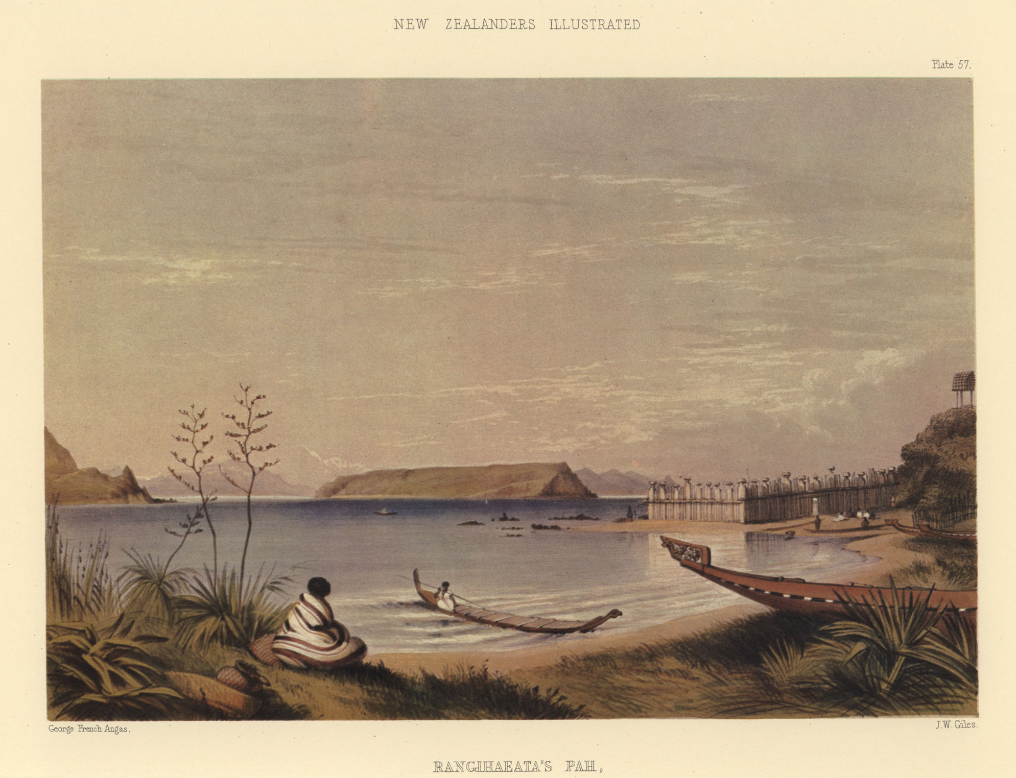
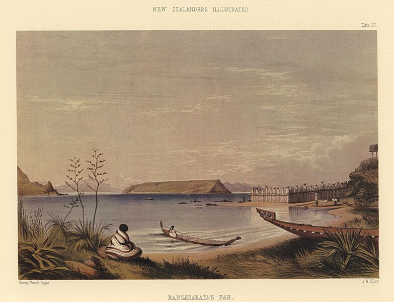
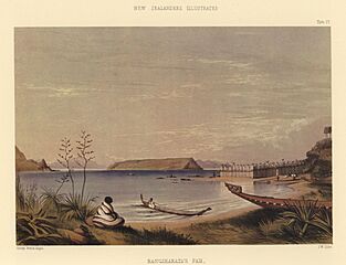
Description: RANGIHAEATA'S PAH, WITH THE ISLAND of MANA AND THE OPPOSITE SHORES OF COOK'S STRAITS. [Image of page 129] PLATE LVII. RANGIHAEATA'S PAH; WITH THE ISLAND of MANA AND THE OPPOSITE SHORES OF COOK'S STRAITS.
SOON after the massacre of Wairau, Rangihaeata erected the stronghold opposite Mana, which is represented in the accompanying plate: it is guarded by enormous wooden posts, sunk very deep into the ground, and firmly lashed together by means of flax rope and aka. The approach to it from seaward is guarded by a reef of rocks running a long way out into the Straits. Above the pah is a wahi tapu, the view from which, looking across Taupo Pah, is given in a preceding plate. Beyond is seen the Island of Mana, or Table Island, at the southern side of which is a small pah belonging to Rangihaeata, where stands his celebrated carved house, called kai tangata, or "eat man" (Plate IV). The opposite shores of Cook's Straits are distinctly visible, with the rugged, and, in many places, snow-capped mountains of the Middle Island, marking the direction of Quee n Charlotte's Sound. In the foreground are canoes belonging to Rauparaha, with the flax (Phormium) growing upon the grassy bank adjoining the beach. Mana is distant about five miles from the mainland, and has long been a celebrated resort of the shore whalers who frequent Cook's Straits.
Usage Terms: Public domain
Image usage
The following page links to this image:
