
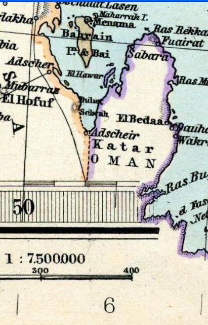
Image: Qatar in Stielers Handatlas 1891 59
Size of this preview: 384 × 599 pixels. Other resolutions: 154 × 240 pixels | 411 × 641 pixels.
Original image (411 × 641 pixels, file size: 64 KB, MIME type: image/jpeg)
Description: Qatar in "Iran and Turan Map by Adolf Stieler map 1891"
Title: Qatar in Stielers Handatlas 1891 59
Credit: → This file has been extracted from another file: Stielers Handatlas 1891 59.jpg
Author: Adolf Stieler
Usage Terms: Creative Commons Attribution-Share Alike 3.0
License: CC BY-SA 3.0
License Link: http://creativecommons.org/licenses/by-sa/3.0
Attribution Required?: Yes
Image usage
The following page links to this image:

All content from Kiddle encyclopedia articles (including the article images and facts) can be freely used under Attribution-ShareAlike license, unless stated otherwise.