
Image: Puerto Rico 2019 2020

Size of this preview: 622 × 599 pixels. Other resolutions: 249 × 240 pixels | 2,341 × 2,256 pixels.
Original image (2,341 × 2,256 pixels, file size: 1.54 MB, MIME type: image/png)
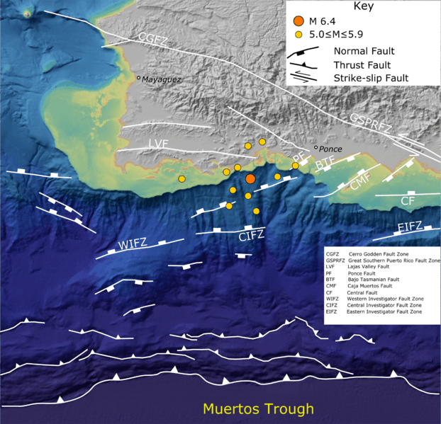
Description: Map of southwestern Puerto Rico and its offshore area showing topography taken from the NOAA DEM Color Shaded Relief layer with the location of active faults taken from Bruna et al. 2015 and Mann et al. 2005 and epicentres of earthquakes of the 2019-2020 Puerto Rico earthquake sequence taken from ANSS
Title: Puerto Rico 2019 2020
Credit: Own work
Author: Mikenorton
Usage Terms: Creative Commons Attribution-Share Alike 4.0
License: CC BY-SA 4.0
License Link: https://creativecommons.org/licenses/by-sa/4.0
Attribution Required?: Yes
Image usage
The following 2 pages link to this image:

All content from Kiddle encyclopedia articles (including the article images and facts) can be freely used under Attribution-ShareAlike license, unless stated otherwise.