
Image: Prelude to Battle of White Sulphur Springs
Size of this preview: 800 × 587 pixels. Other resolutions: 320 × 235 pixels | 837 × 614 pixels.
Original image (837 × 614 pixels, file size: 367 KB, MIME type: image/png)
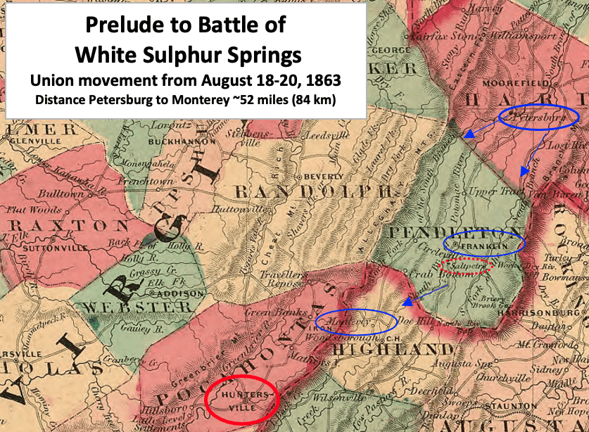
Description: This map shows the first few days of Br. Gen. William W. Averell's first West Virginia Raid that led to the Battle of White Sulphur Springs in August 1863 during the American Civil War.
Title: Prelude to Battle of White Sulphur Springs
Credit: This is a crop of an 1864 map created by Alvin Jewett Johnson. The entire map can be found in the Library of Congress here, and shows Virginia, Delaware, Maryland & West Virginia. Text box and arrows etc. were added by TwoScarsUp based on William W. Averell's September 1, 1863 report in Official Records XXIX p. 33.
Author: Alvin Jewett Johnson (1827-1884)
Usage Terms: Public domain
License: Public domain
Attribution Required?: No
Image usage
The following page links to this image:

All content from Kiddle encyclopedia articles (including the article images and facts) can be freely used under Attribution-ShareAlike license, unless stated otherwise.