
Image: Prairieduchientreatymap1829
Size of this preview: 669 × 599 pixels. Other resolutions: 268 × 240 pixels | 1,116 × 1,000 pixels.
Original image (1,116 × 1,000 pixels, file size: 94 KB, MIME type: image/png)
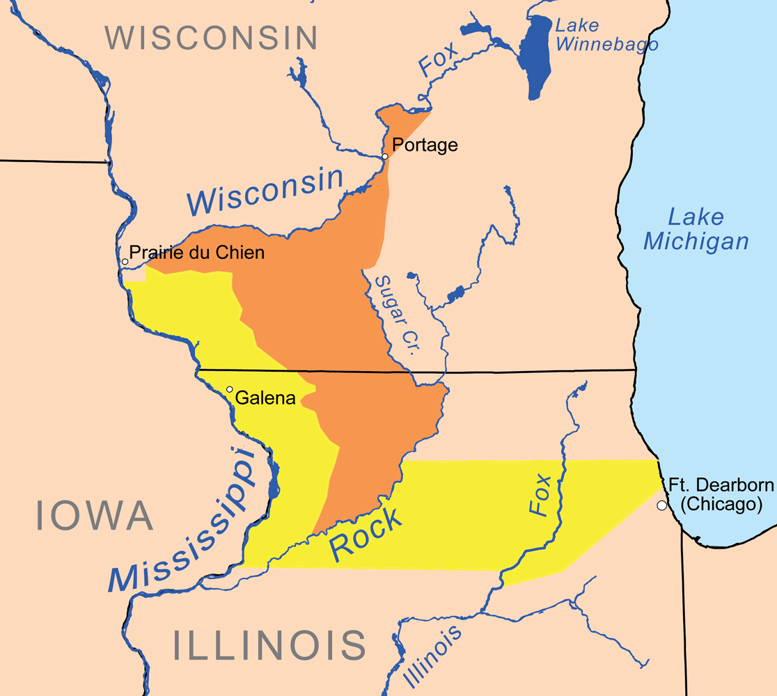
Description: Map showing lands ceded in the 1829 Treaty of Prairie du Chien by the Chippewa, Ottawa, and Potawatomi tribes in yellow and the Winnebago in orange.
Title: Prairieduchientreatymap1829
Credit: Own work, background features are from the National Atlas. Cession border is based on treaty text and maps in Indian land cessions in the United States, Library of Congress, 1899.
Author: Kmusser
Usage Terms: Creative Commons Attribution-Share Alike 3.0
License: CC BY-SA 3.0
License Link: https://creativecommons.org/licenses/by-sa/3.0
Attribution Required?: Yes
Image usage
The following 3 pages link to this image:

All content from Kiddle encyclopedia articles (including the article images and facts) can be freely used under Attribution-ShareAlike license, unless stated otherwise.