
Image: Potomac River, Maryland and Virginia Border 1861
Size of this preview: 732 × 600 pixels. Other resolutions: 293 × 240 pixels | 1,191 × 976 pixels.
Original image (1,191 × 976 pixels, file size: 531 KB, MIME type: image/jpeg)
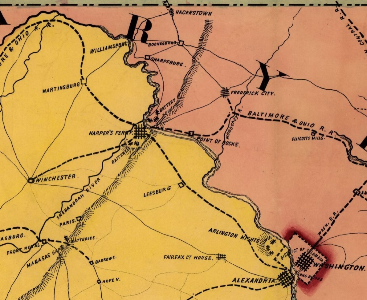
Description: Virginia and Maryland borders along the Potomac River during the American Civil War, showing Washington, DC, Harper's Ferry, Hagerstown and other towns along the borders.
Title: Potomac River, Maryland and Virginia Border 1861
Credit: Library of Congress
Author: Bufford, John Henry, 1810-1870.
Usage Terms: Public domain
License: Public domain
Attribution Required?: No
Image usage
The following page links to this image:

All content from Kiddle encyclopedia articles (including the article images and facts) can be freely used under Attribution-ShareAlike license, unless stated otherwise.