
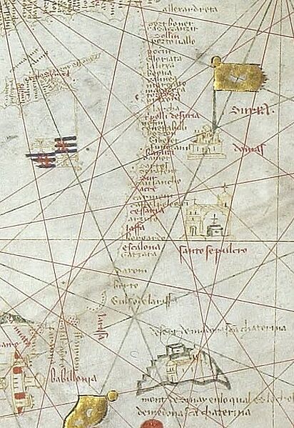
Image: Portolan chart of Guillem Soler (c.1380, Paris) Israel

Size of this preview: 412 × 599 pixels. Other resolutions: 165 × 240 pixels | 545 × 793 pixels.
Original image (545 × 793 pixels, file size: 130 KB, MIME type: image/jpeg)
Description: Portolan chart signed by Majorcan cartographer Guillem Soler (Guillelmus Soleri, Guglielmo Soleri) but undated (est. c.1380, but could be anywhere between 1368 and 1385), held by the Bibliothèque nationale de France in Paris, France. (Bibliothèque nationale de France)
Title: Guillmus Soleri civis maioricaru me fecit
Credit: This file has been extracted from another file
Author: Guillem Soler
Usage Terms: Public domain
License: Public domain
Attribution Required?: No
Image usage
The following page links to this image:

All content from Kiddle encyclopedia articles (including the article images and facts) can be freely used under Attribution-ShareAlike license, unless stated otherwise.
_Israel.jpg)