
Image: Portland OR aerial

Size of this preview: 800 × 417 pixels. Other resolutions: 320 × 167 pixels | 1,512 × 789 pixels.
Original image (1,512 × 789 pixels, file size: 410 KB, MIME type: image/jpeg)
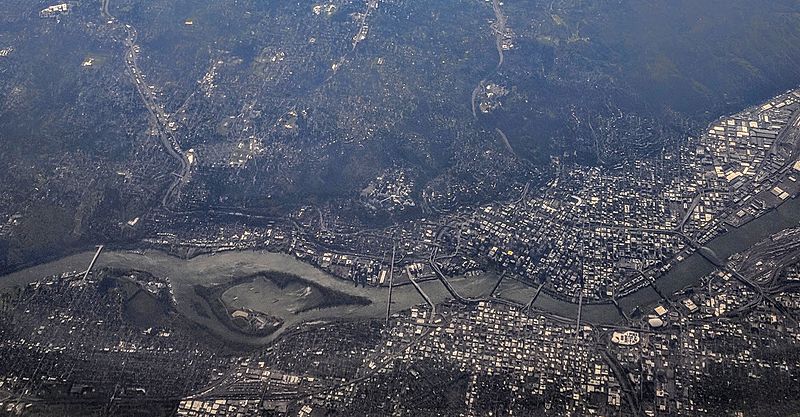
Description: Aerial view of Portland, Oregon, and its bridges across the Willamette River. This view is looking generally west (or west-southwest), with downtown being the densely developed area "above" (west of) the river from this angle, and the Central Eastside Industrial District being "below" the river from this angle. The island in the river is Ross Island.
Title: Portland OR aerial
Credit: Own work
Author: Dicklyon
Usage Terms: Creative Commons Attribution-Share Alike 4.0
License: CC BY-SA 4.0
License Link: https://creativecommons.org/licenses/by-sa/4.0
Attribution Required?: Yes
Image usage
The following page links to this image:

All content from Kiddle encyclopedia articles (including the article images and facts) can be freely used under Attribution-ShareAlike license, unless stated otherwise.