
Image: Port Lihou Island and Packe Island (Landsat)
No higher resolution available.
Port_Lihou_Island_and_Packe_Island_(Landsat).jpg (256 × 256 pixels, file size: 6 KB, MIME type: image/jpeg)
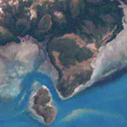
Description: Port Lihou Island (middle) and Packe Island (bottom, left). Upper screen shows south-east coast of Prince-of-Wales-Island, Torres Strait Islands, Queensland, Australia
Title: Port Lihou Island and Packe Island (Landsat)
Credit: http://oceancolor.gsfc.nasa.gov/cgi/landsat_extract.pl?path=99&row=67&x=1617&y=2403&n=0&t=321
Author: NASA
Usage Terms: Public domain
License: Public domain
Attribution Required?: No
Image usage
The following page links to this image:

All content from Kiddle encyclopedia articles (including the article images and facts) can be freely used under Attribution-ShareAlike license, unless stated otherwise.
.jpg)