Image: Port Gibson Battlefield Mississippi

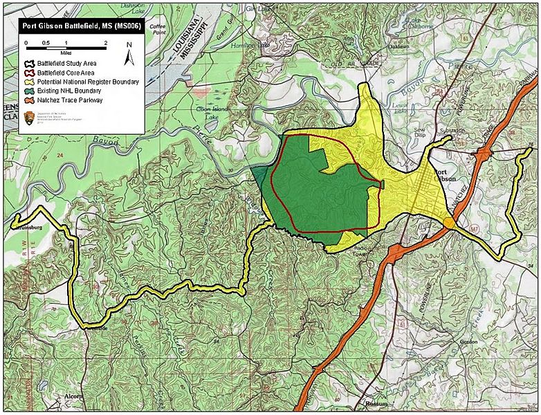
Description: Map of battlefield core and study areas. The ABPP expanded the Study Area to include the route of Federal advance from their landing at Bruinsburg and the Confederate retreat routes across Bayou Pierre where Federal pursuit ended. The Bruinsburg route is included for its significance as the opening movement of the campaign on the Mississippi side of the river, and because additional Federal troops arrived by this route throughout the day. The Study Area was also enlarged to include the historic boundaries of the Buck Creek and Bayou Pierre waterways – obstacles that dictated troop movements during the battle. The ABPP expanded the Core Area in the north to include the Confederate lines and sweeping Federal assault and in the south to include the location of fighting around Magnolia Church.
Title: Port Gibson Battlefield Mississippi
Credit: National Park Service
Author: American Battlefield Protection Program
Usage Terms: Public domain
License: Public domain
Attribution Required?: No
Image usage
The following page links to this image:

