
Image: Population growth by Pakistani district
Size of this preview: 800 × 450 pixels. Other resolutions: 320 × 180 pixels | 3,840 × 2,160 pixels.
Original image (3,840 × 2,160 pixels, file size: 972 KB, MIME type: image/png)
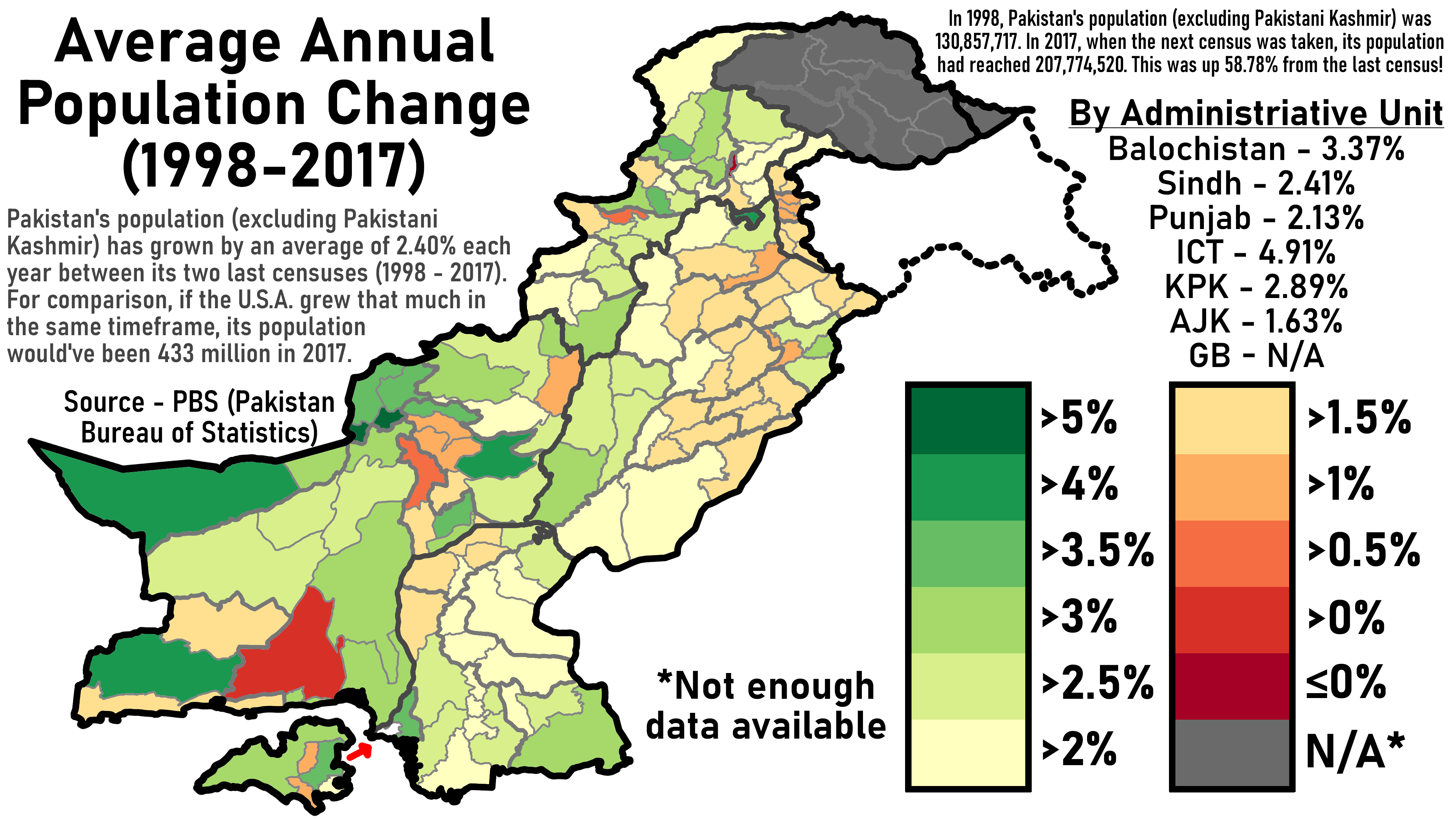
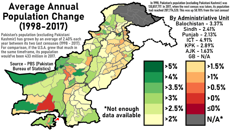
Description: This is a District-by-district Map of Average Annual Population Change by district between 1998 and 2017. It uses data from the PBS (Pakistan Bureau of Statistics) for Punjab, Sindh, ICT, KPK, and Balochistan, and for Azad Jammu & Kashmir, data from the government is used. Gilgit-Baltistan does not have detailed data available for the year 2017.
Title: Population growth by Pakistani district
Credit: Own work
Author: Abdullah Ali Abbasi
Usage Terms: Creative Commons Attribution-Share Alike 4.0
License: CC BY-SA 4.0
License Link: https://creativecommons.org/licenses/by-sa/4.0
Attribution Required?: Yes
Image usage
The following image is a duplicate of this image (more details):
The following page links to this image:

All content from Kiddle encyclopedia articles (including the article images and facts) can be freely used under Attribution-ShareAlike license, unless stated otherwise.