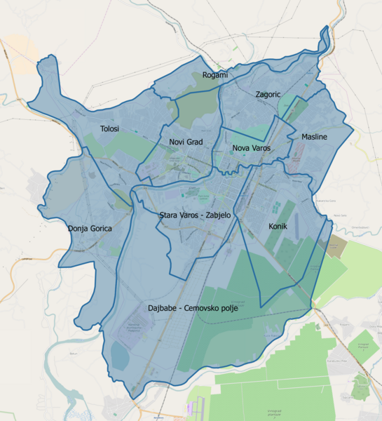
Image: PodgoricaUrbanSubdivisions

Size of this preview: 545 × 600 pixels. Other resolutions: 218 × 240 pixels | 1,680 × 1,848 pixels.
Original image (1,680 × 1,848 pixels, file size: 1.86 MB, MIME type: image/png)
Description: Planning zones of Podgorica city proper, Montenegro. Open Street Map open source maps have been used as background, while borders of the zones were drawn according to official local government paper
Title: PodgoricaUrbanSubdivisions
Credit: Own work
Author: Nije bitno...
Usage Terms: Creative Commons Attribution-Share Alike 4.0
License: CC BY-SA 4.0
License Link: http://creativecommons.org/licenses/by-sa/4.0
Attribution Required?: Yes
Image usage
The following page links to this image:

All content from Kiddle encyclopedia articles (including the article images and facts) can be freely used under Attribution-ShareAlike license, unless stated otherwise.
