
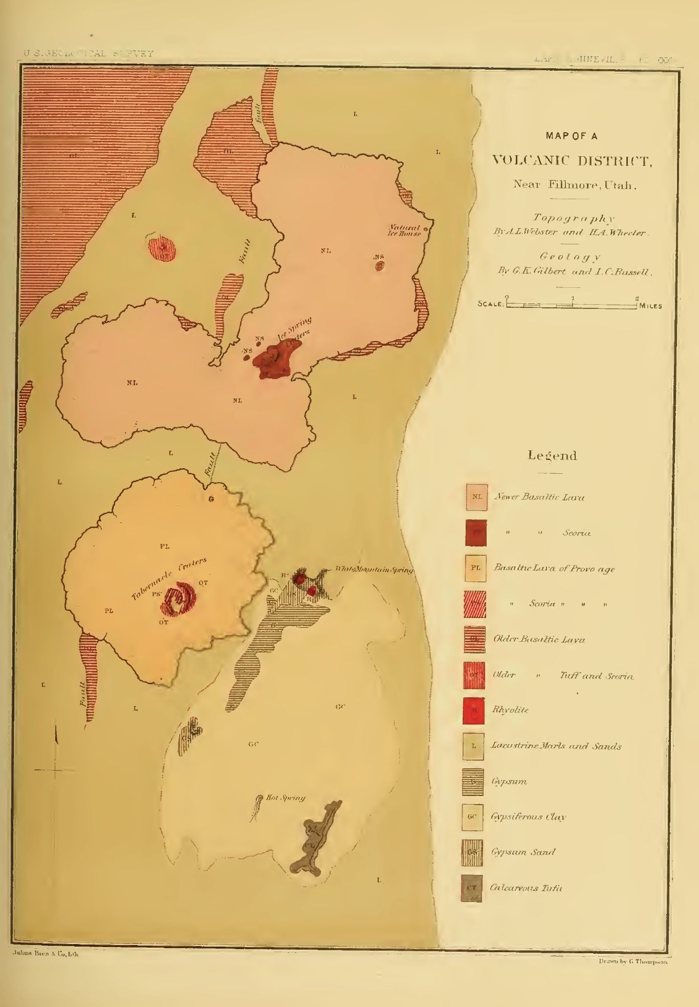
Image: Plate 35 Map of a Volcanic District near Fillmore, Utah
Size of this preview: 416 × 599 pixels. Other resolutions: 167 × 240 pixels | 1,366 × 1,966 pixels.
Original image (1,366 × 1,966 pixels, file size: 208 KB, MIME type: image/jpeg)
Description: Plate 35 Map of a Volcanic District near Fillmore, Utah
Title: Plate 35 Map of a Volcanic District near Fillmore, Utah
Credit: Lake Bonneville; Grove Karl Gilbert; Department of the Interior Monographs; United States Geological Survey, Volume I; United States Geological Survey, J. W. Powell, Director: Washington, D.C., Government Printing Office; 1890
Author: G. Thompson, U.S. Geological Survey employee
Usage Terms: Public domain
License: Public domain
Attribution Required?: No
Image usage
The following 2 pages link to this image:

All content from Kiddle encyclopedia articles (including the article images and facts) can be freely used under Attribution-ShareAlike license, unless stated otherwise.