
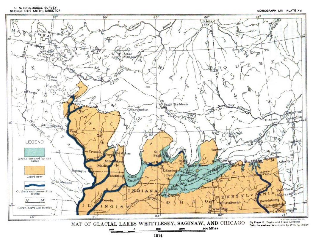
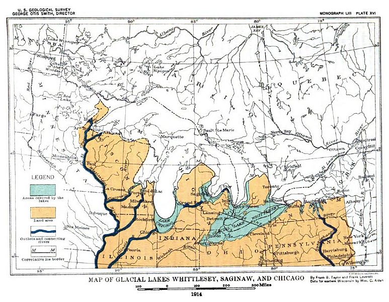
Image: Plate 16 - Glacial lakes Whittlesey, Sagniaw and Chicago
Size of this preview: 773 × 600 pixels. Other resolutions: 310 × 240 pixels | 1,052 × 816 pixels.
Original image (1,052 × 816 pixels, file size: 180 KB, MIME type: image/jpeg)
Description: Map of Glacial lakes Whittlesey, Sagniaw and Chicago, based on the USGS Report of 1915
Title: Plate 16 - Glacial lakes Whittlesey, Sagniaw and Chicago
Credit: The Pleistocene of Indiana and Michigan and the History of the Great Lakes; U.S. Geological Survey, Monograph, #53; Government Printing Office; Washington, D.C.; 1915
Author: Frank Leverett and Frank B. Taylor
Usage Terms: Public domain
License: Public domain
Attribution Required?: No
Image usage
The following 3 pages link to this image:

All content from Kiddle encyclopedia articles (including the article images and facts) can be freely used under Attribution-ShareAlike license, unless stated otherwise.