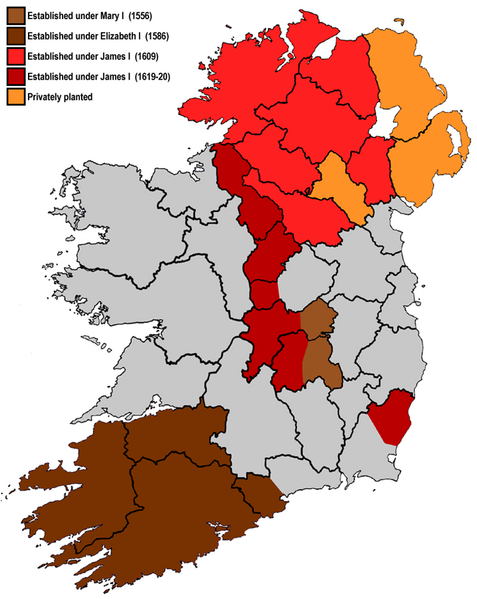
Image: Plantations in Ireland

Size of this preview: 477 × 599 pixels. Other resolutions: 191 × 240 pixels | 700 × 879 pixels.
Original image (700 × 879 pixels, file size: 87 KB, MIME type: image/png)
Description: A map highlighting the areas subjected to British plantations in Ireland. Although the plantations in Munster did not cover the entire shaded area, it has been simplified for the purposes of this map. Modern county boundaries are also shown.
Title: Plantations in Ireland
Credit: Based on [1], [2], [3].
Author: User:Asarlaí
Usage Terms: Creative Commons Attribution-Share Alike 4.0
License: CC BY-SA 4.0
License Link: https://creativecommons.org/licenses/by-sa/4.0
Attribution Required?: Yes
Image usage
The following 2 pages link to this image:

All content from Kiddle encyclopedia articles (including the article images and facts) can be freely used under Attribution-ShareAlike license, unless stated otherwise.
