
Image: Plans & views of Rebel defences, coast of South Carolina (5121171170)
Size of this preview: 433 × 600 pixels. Other resolutions: 173 × 240 pixels | 1,444 × 2,000 pixels.
Original image (1,444 × 2,000 pixels, file size: 1.82 MB, MIME type: image/jpeg)
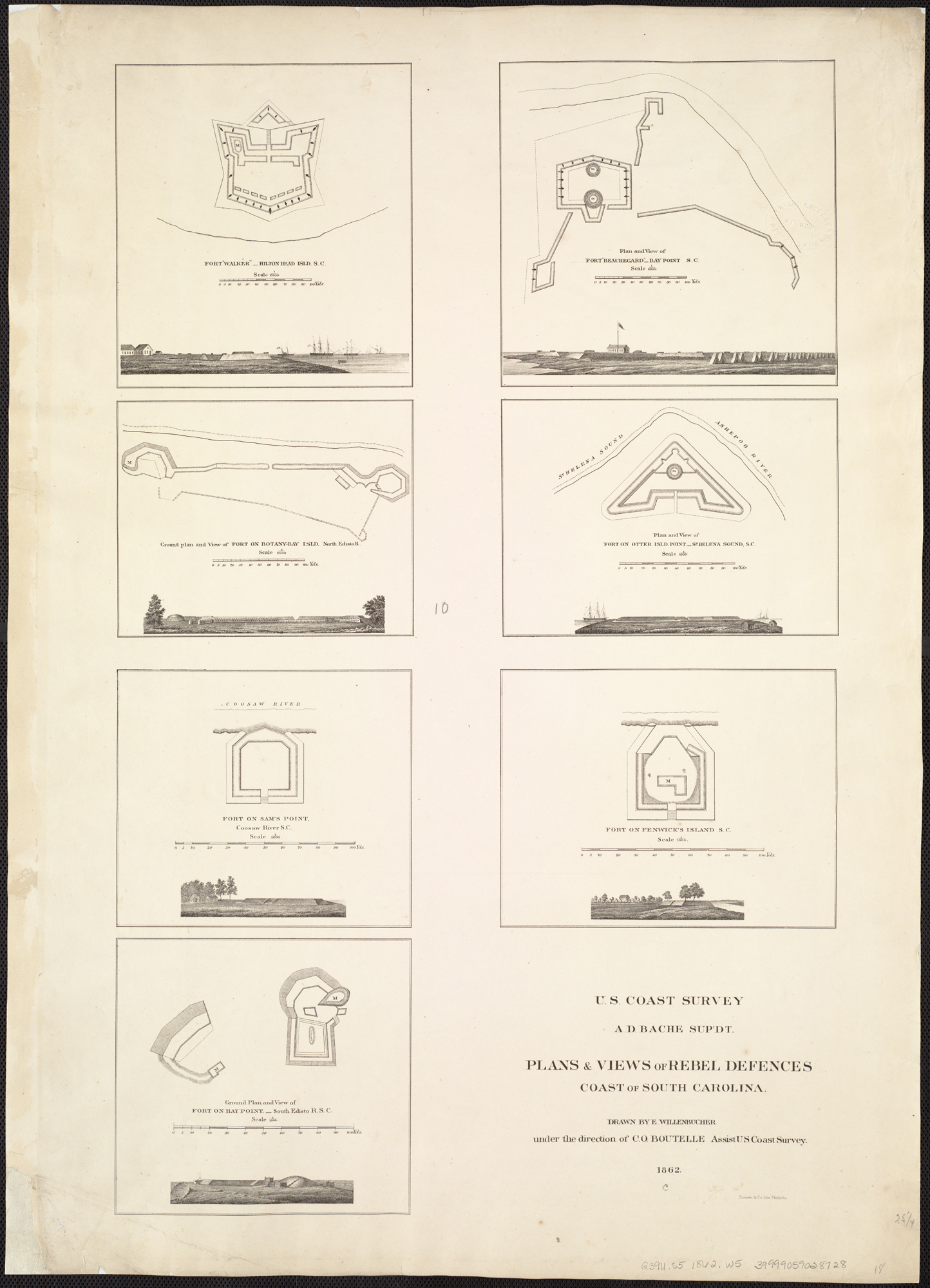
Description: Zoom into this map at maps.bpl.org. Author: Willenbücher, Eugene Publisher: United States Coast Survey Date: 1862 Location: South Carolina Dimension: 65x45cm Scale: Scales differ Call Number: G3911.S5 1862 .W5
Title: Plans & views of Rebel defences, coast of South Carolina (5121171170)
Credit: Plans & views of Rebel defences, coast of South Carolina Uploaded by tm
Author: http://maps.bpl.org
Usage Terms: Creative Commons Attribution 2.0
License: CC BY 2.0
License Link: https://creativecommons.org/licenses/by/2.0
Attribution Required?: Yes
Image usage
The following page links to this image:

All content from Kiddle encyclopedia articles (including the article images and facts) can be freely used under Attribution-ShareAlike license, unless stated otherwise.
.jpg)