
Image: Plan of the harbour, fort and town of York, the capital of Upper Canada (March 16th, 1816)

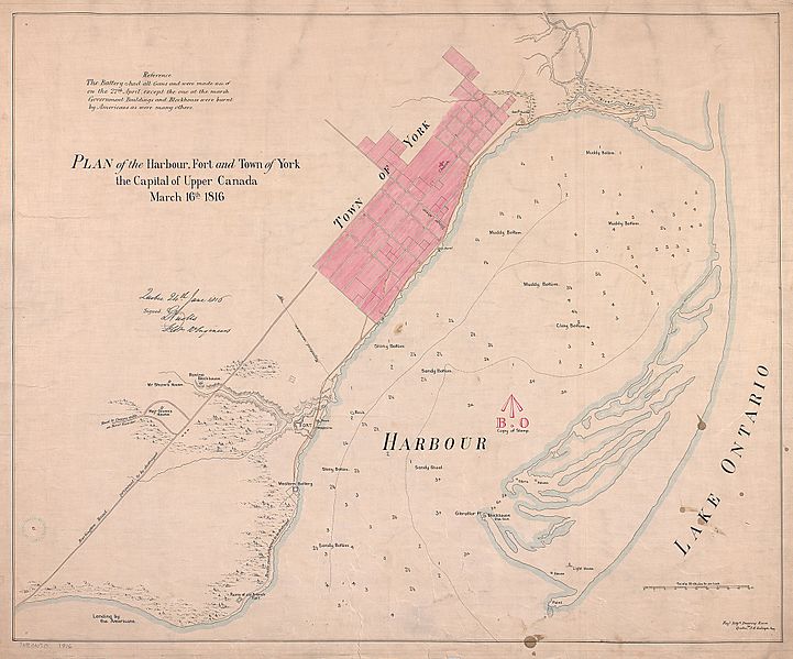
Description: A plan of of the harbour, fort and town of York, the capital of Upper Canada (and the future site of Toronto, Ontario Canada). The distance between the town of York and the fort added to the difficulties of organizing and commanding thethe defending troops and of staving off the Americans during the Battle of York in 1813. This plan shows locations of the town, the fort and various military buildings, government buildings, Major James Givin’s house, Major General Aeneus Shaw’s house and the landing site of the American troops.
Title: Plan of the harbour, fort and town of York, the capital of Upper Canada (March 16th, 1816)
Credit: This image is available from the Toronto Public Library under the reference number MAPS-R-149 ; E11_maptl1816_Plan of the Harbour, fort and town of York, the capital of U.C
Author: Nicolls, GustavusPublished: Royal Engineers, Quebec, 1816
Usage Terms: Public domain
License: Public domain
Attribution Required?: No
Image usage
The following page links to this image:

.jpg)