
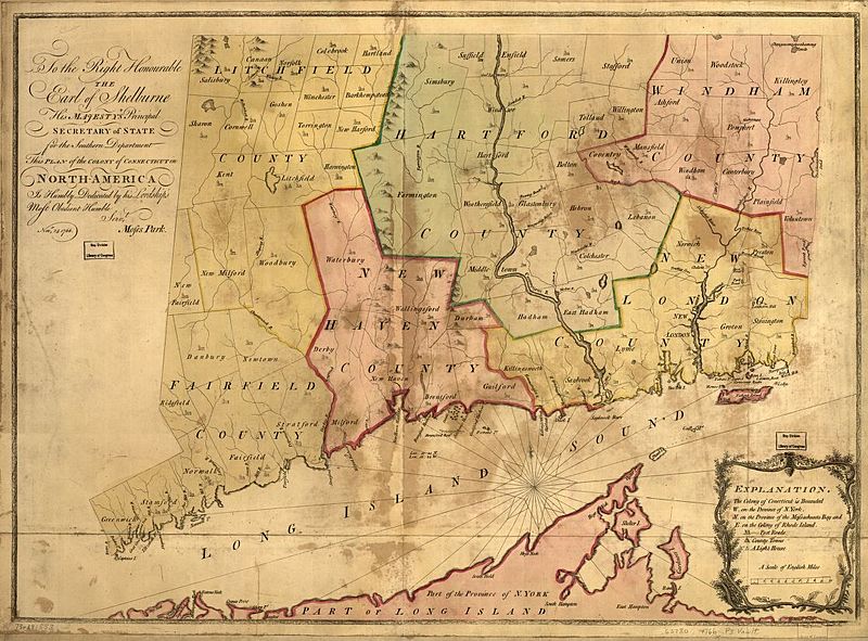
Image: Plan of the Colony of Connecticut, Moses Park, 1766

Size of this preview: 800 × 591 pixels. Other resolutions: 320 × 237 pixels | 1,116 × 825 pixels.
Original image (1,116 × 825 pixels, file size: 220 KB, MIME type: image/jpeg)
Description: Map of the colony of Connecticut circa. 1766 Relief shown pictorially Shows counties, towns, rivers, and post roads.
Title: Plan of the Colony of Connecticut, Moses Park, 1766
Credit: Library of Congress, Geography and Map Division Catalog Number 73691553
Author: Park, Moses Lansdowne, William Petty, Marquis of, 1737-1805
Usage Terms: Public domain
License: Public domain
Attribution Required?: No
Image usage
The following 2 pages link to this image:

All content from Kiddle encyclopedia articles (including the article images and facts) can be freely used under Attribution-ShareAlike license, unless stated otherwise.