
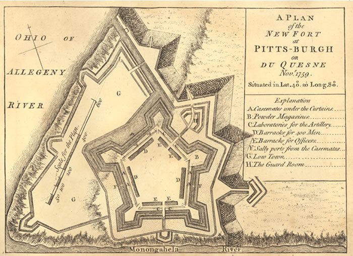
Image: Plan of Fort Pitt, 1759
No higher resolution available.
Plan_of_Fort_Pitt,_1759.jpg (700 × 508 pixels, file size: 112 KB, MIME type: image/jpeg)
Description: Fort Pitt (Pennsylvania), map published in 1765, drawn by John Rocque.
Title: Plan of Fort Pitt, 1759
Usage Terms: Public domain
License: Public domain
Attribution Required?: No
Image usage
The following 4 pages link to this image:

All content from Kiddle encyclopedia articles (including the article images and facts) can be freely used under Attribution-ShareAlike license, unless stated otherwise.