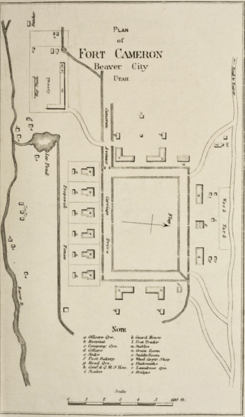
Image: Plan of Fort Cameron

Size of this preview: 352 × 599 pixels. Other resolutions: 141 × 240 pixels | 1,386 × 2,357 pixels.
Original image (1,386 × 2,357 pixels, file size: 1.48 MB, MIME type: image/png)
Description: Map showing plan of Fort Cameron, Utah Territory. First named Post of Beaver (May 25, 1872), it was renamed Fort Cameron, July 1, 1874. Surveyed May, 1872. Designed for four companies
Title: Plan of Fort Cameron
Credit: Outline Descriptions of the Posts in the Military Divison of the Missouri, commanded by Lieutenant General P.H. Sheridan. Chicago, 1876. http://archive.loc/details/GR_4327
Author: Unknown authorUnknown author
Usage Terms: Public domain
License: Public domain
Attribution Required?: No
Image usage
The following page links to this image:

All content from Kiddle encyclopedia articles (including the article images and facts) can be freely used under Attribution-ShareAlike license, unless stated otherwise.
