
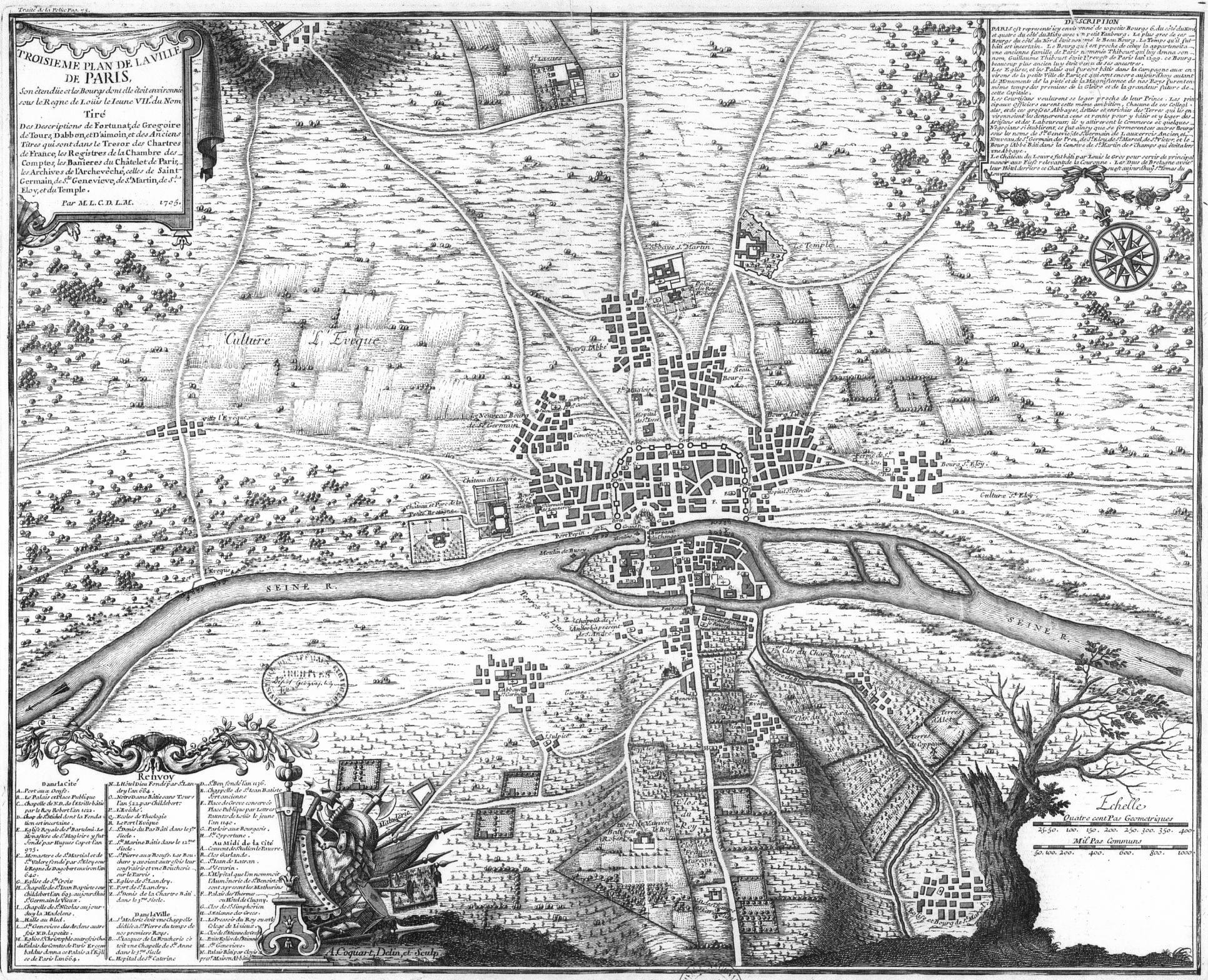
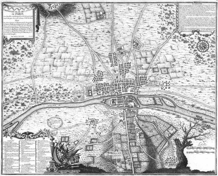
Image: Plan de Paris 1180 BNF07710746
Size of this preview: 739 × 600 pixels. Other resolutions: 296 × 240 pixels | 1,932 × 1,568 pixels.
Original image (1,932 × 1,568 pixels, file size: 2.48 MB, MIME type: image/png)
Description: Plan of Paris about 1180, the third of eight chronological maps of Paris from Traité de la police
Title: Troisième plan de la ville de Paris, son étendüe et les bourgs dont elle étoit environnée sous le regne de Loüis le Ieune VIIe du nom [Image fixe numérisée] / Par M.L.C.D.L.M.
Credit: Gallica
Author: Nicolas de La Mare / Antoine Coquart
Usage Terms: Public domain
License: Public domain
Attribution Required?: No
Image usage
The following page links to this image:

All content from Kiddle encyclopedia articles (including the article images and facts) can be freely used under Attribution-ShareAlike license, unless stated otherwise.