
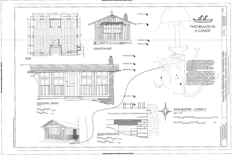
Image: Plan, North and East Elevation, and Foundation Detail - Manatoc Reservation, Dan Boone Cabin, 1075 Truxell Road, Peninsula, Summit County, OH HABS OH-2483-D (sheet 1 of 1)
Title: Plan, North and East Elevation, and Foundation Detail - Manatoc Reservation, Dan Boone Cabin, 1075 Truxell Road, Peninsula, Summit County, OH
Credit: https://www.loc.gov/pictures/item/oh1979.sheet.00001a
Author: Related names: Murphy, Elizabeth Corbin, faculty sponsor Johnson, Christopher, delineator
Permission: Public domainPublic domainfalsefalse This image or media file contains material based on a work of a National Park Service employee, created as part of that person's official duties. As a work of the U.S. federal government, such work is in the public domain in the United States. See the NPS website and NPS copyright policy for more information.
Usage Terms: Public domain
License: Public domain
Attribution Required?: No
Image usage
The following page links to this image:
