
Image: Pick-Sloan Plan
Size of this preview: 800 × 529 pixels. Other resolutions: 320 × 212 pixels | 831 × 550 pixels.
Original image (831 × 550 pixels, file size: 54 KB, MIME type: image/png)
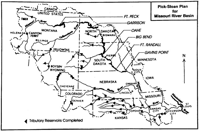
Description: "Pick-Sloan Plan for Missouri River Basin". Note: The map highlights Fort Peck Dam which was built by the US Army Corps of Engineers in 1940 before the Pick-Sloan Project. It does not highlight Canyon Ferry Dam that has been part of Pick-Sloan but was constructed by the Bureau of Reclamation.
Title: Pick-Sloan Plan
Credit: Builders and Fighters: U.S. Army Engineers in World War II, United States Army Corps of Engineers. Office of History, 1992 sec. IV (18 December 1992), p. 233. Publication #EP 870-1-42
Author: United States Army Corps of Engineers. Office of History
Usage Terms: Public domain
License: Public domain
Attribution Required?: No
Image usage
The following 2 pages link to this image:

All content from Kiddle encyclopedia articles (including the article images and facts) can be freely used under Attribution-ShareAlike license, unless stated otherwise.