Image: Piccadilly,-Manchester-map

Size of this preview: 696 × 600 pixels. Other resolutions: 279 × 240 pixels | 808 × 696 pixels.
Original image (808 × 696 pixels, file size: 162 KB, MIME type: image/png)
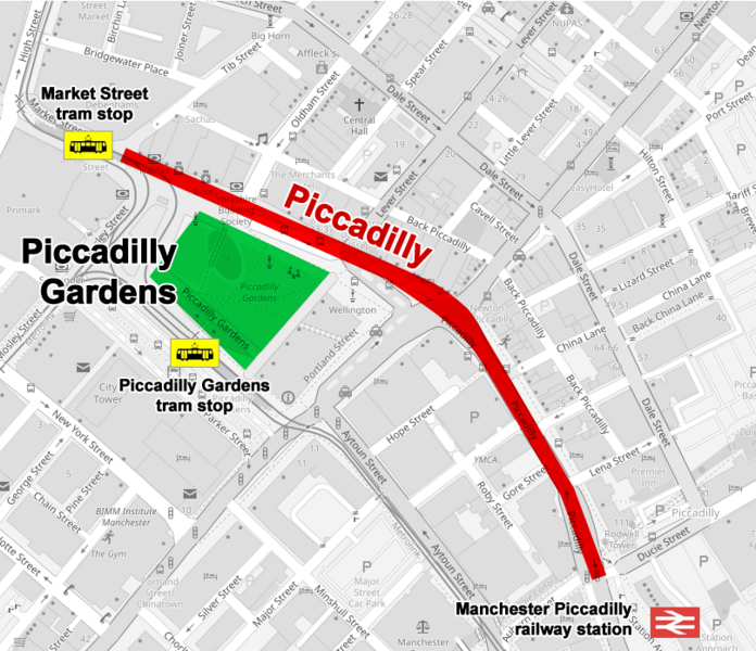
Description: Map of the street named Piccadilly in central Manchester, UK. It begins at the junction of market Street and Tib Street, passes along the north side of Piccadilly Gardens for approximately 470 metres and ends at the junction with Ducie Street and London Road
Title: Piccadilly,-Manchester-map
Credit: Own work
Author: Cnbrb
Usage Terms: Creative Commons Attribution-Share Alike 4.0
License: CC BY-SA 4.0
License Link: https://creativecommons.org/licenses/by-sa/4.0
Attribution Required?: Yes
Image usage
The following page links to this image:

All content from Kiddle encyclopedia articles (including the article images and facts) can be freely used under Attribution-ShareAlike license, unless stated otherwise.
