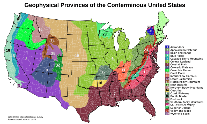
Image: Physiographic Provinces 48 Conterminous US-v1

Description: The major physiographic provinces of the 48 conterminous United States. This map is based on public domain data from the USGS[1] Originator: Fenneman, N.M., and Johnson, D.W. Publication_Date: 1946 Title: Physiographic divisions of the conterminous U. S. Geospatial_Data_Presentation_Form: map Publication_Place: Washington, DC Publisher: USGS The data is presented in an Lambert equal area projection described in "proj" format as: "+proj=leac +lat_1=29.5 +lat_2=45.5 +lat_0=23 +lon_0=-100 +x_0=0 +y_0=0 +ellps=clrk66 +datum=NAD83 +units=m +no_defs"
Title: Physiographic Provinces 48 Conterminous US-v1
Credit: Own work
Author: Kbh3rd
Usage Terms: Creative Commons Attribution 3.0
License: CC BY 3.0
License Link: https://creativecommons.org/licenses/by/3.0
Attribution Required?: Yes
Image usage
The following page links to this image:

