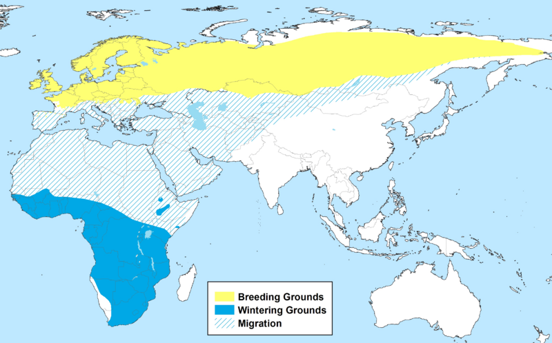
Image: Phylloscopus trochilus Range Map

Size of this preview: 800 × 498 pixels. Other resolutions: 320 × 199 pixels | 3,286 × 2,046 pixels.
Original image (3,286 × 2,046 pixels, file size: 475 KB, MIME type: image/png)
Description: Yellow: breeding grounds Blue: wintering grounds Cross-hatched: migration range
Title: Phylloscopus trochilus Range Map
Credit: I created this map using ESRI ArcMap 10 with the digital range map provided on the "The Bird species distribution maps of the world, version 1.0" page from the BirdLife International website. The BirdLife International terms of agreement for the use of the digital range maps can be found at: http://www.birdlife.org/datazone/info/dataterms
Author: Keithwlarson
Usage Terms: Creative Commons Attribution-Share Alike 3.0
License: CC BY-SA 3.0
License Link: https://creativecommons.org/licenses/by-sa/3.0
Attribution Required?: Yes
Image usage
The following page links to this image:

All content from Kiddle encyclopedia articles (including the article images and facts) can be freely used under Attribution-ShareAlike license, unless stated otherwise.
