
Image: Phoenicia map-en

Size of this PNG preview of this SVG file: 610 × 405 pixels. Other resolution: 320 × 212 pixels.
Original image (SVG file, nominally 610 × 405 pixels, file size: 339 KB)
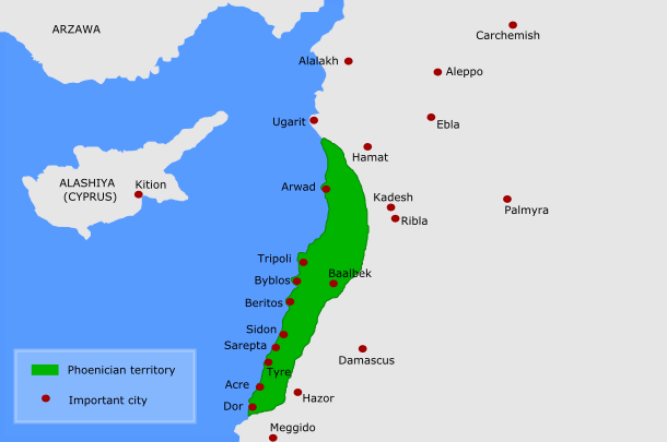
Description: "map of Phoenicia", apparently intended to give a rough idea of the part of the Levant known as "Phoenicia", it does not correspond to any historical empire or polity. The cities indicated are the ancient Phoenician city states, perhaps in the Late Bronze Age (?)
Title: Phoenicia map-en
Credit: This map
Author: Kordas, based on Alvaro's work
Permission: Italian Spanish Arabic
Usage Terms: Creative Commons Attribution 3.0
License: CC BY 3.0
License Link: http://creativecommons.org/licenses/by/3.0
Attribution Required?: Yes
Image usage
The following page links to this image:

All content from Kiddle encyclopedia articles (including the article images and facts) can be freely used under Attribution-ShareAlike license, unless stated otherwise.