
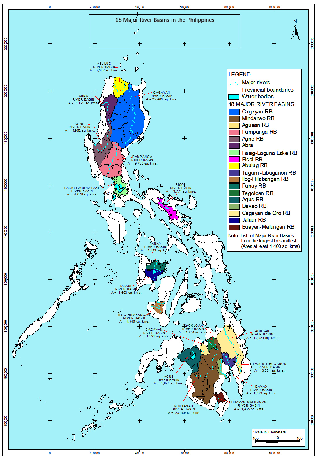
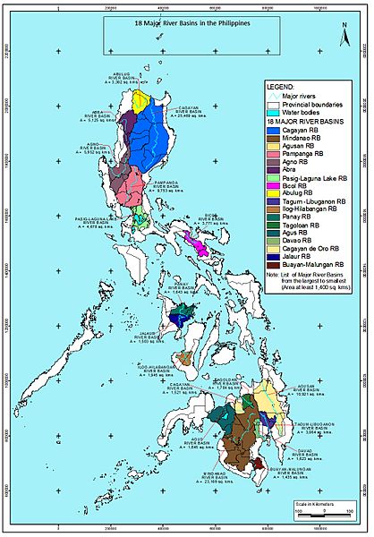
Image: Philippine-Water-Resources-Region Map
Size of this preview: 418 × 600 pixels. Other resolutions: 167 × 240 pixels | 1,099 × 1,577 pixels.
Original image (1,099 × 1,577 pixels, file size: 606 KB, MIME type: image/jpeg)
Description: 18 Major River Basins in the Philippines Philippine Water Resources Region Map
Title: Philippine-Water-Resources-Region Map
Credit: http://www.nwrb.gov.ph/images/Site_image/Water-Resources-Region_Map.jpg
Author: National Water Resources Board, Republic of the Philippines
Usage Terms: Public domain
License: Public domain
Attribution Required?: No
Image usage
The following page links to this image:

All content from Kiddle encyclopedia articles (including the article images and facts) can be freely used under Attribution-ShareAlike license, unless stated otherwise.