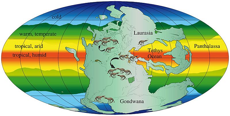
Image: Permian–Triassic paleoclimate

Size of this preview: 800 × 405 pixels. Other resolutions: 320 × 162 pixels | 1,558 × 788 pixels.
Original image (1,558 × 788 pixels, file size: 362 KB, MIME type: image/jpeg)
Description: Palaeogeographic map of the Permo-Triassic, showing the single supercontinent Pangaea, modelled climate belts, and the distributions of terrestrial tetrapods. Tetrapods were distributed worldwide before and after the PTME crisis, but moved 10–15° polewards as a result of tropical overheating. The shift north is documented, but the fossil record is not good enough to document the Southern Hemisphere action.
Title: Permian–Triassic paleoclimate
Credit: https://doi.org/10.1098/rsta.2017.0076
Author: Massimo Bernardi
Usage Terms: Creative Commons Attribution 4.0
License: CC BY 4.0
License Link: https://creativecommons.org/licenses/by/4.0
Attribution Required?: Yes
Image usage
The following page links to this image:

All content from Kiddle encyclopedia articles (including the article images and facts) can be freely used under Attribution-ShareAlike license, unless stated otherwise.
