
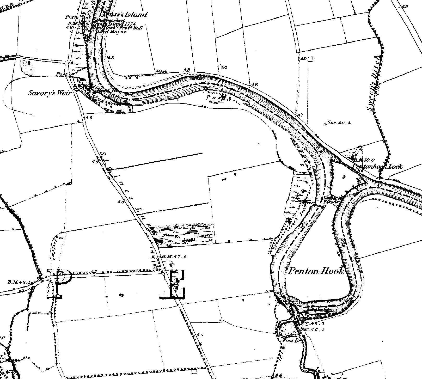
Image: Penton Hook and Savory's Weir
Size of this preview: 668 × 600 pixels. Other resolutions: 267 × 240 pixels | 1,619 × 1,454 pixels.
Original image (1,619 × 1,454 pixels, file size: 353 KB, MIME type: image/jpeg)
Description: Sheet 024 Ashford, Chertsey, Egham, Englefield Green, Laleham, Littleton, Lyne, Shepperton, Staines, Stroude, Thorpe, Thorpe Green, Thorpe Lea, Trumps Green, Virginia Water, TW15 2, KT16 9, TW20 9, TW20 0, TW18 2, TW17 0, KT16 0, TW17 9, TW18 3, GU25 4, TW20 8
Title: Map of Middlesex
Credit: http://www.british-history.ac.uk/os-1-to-10560/middlesex/024
Author: Ordnance Survey
Usage Terms: Public domain
License: Public domain
Attribution Required?: No
Image usage
The following page links to this image:

All content from Kiddle encyclopedia articles (including the article images and facts) can be freely used under Attribution-ShareAlike license, unless stated otherwise.