
Image: Pennsylvania Avenue Historic Site boundaries
Size of this preview: 800 × 473 pixels. Other resolutions: 320 × 189 pixels | 914 × 540 pixels.
Original image (914 × 540 pixels, file size: 270 KB, MIME type: image/jpeg)
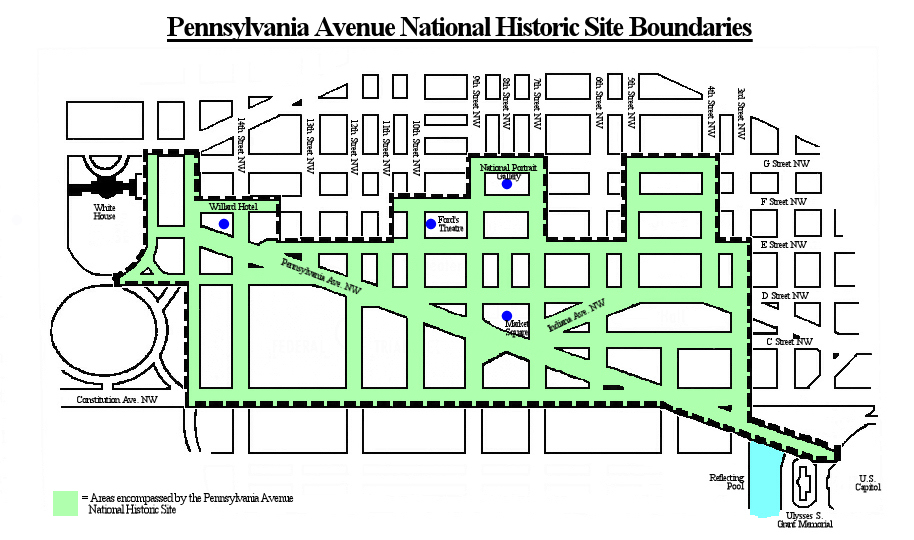
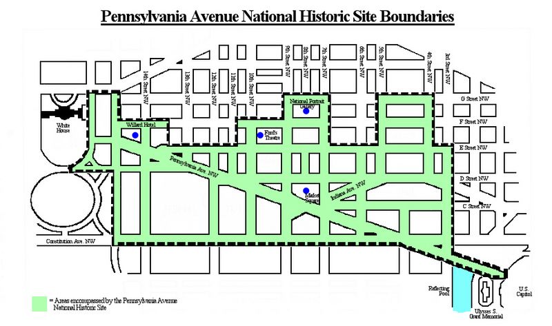
Description: Map of downtown Washington, D.C., in the United States, showing the boundaries (in green) of the Pennsylvania Avenue National Historic Site. Boundaries per Eisen, Jack. "Avenue Given Historic Site Designation." Washington Post. October 1, 1965.
Title: Pennsylvania Avenue Historic Site boundaries
Credit: Own work
Author: Tim1965
Usage Terms: Creative Commons Attribution-Share Alike 3.0
License: CC BY-SA 3.0
License Link: https://creativecommons.org/licenses/by-sa/3.0
Attribution Required?: Yes
Image usage
The following page links to this image:

All content from Kiddle encyclopedia articles (including the article images and facts) can be freely used under Attribution-ShareAlike license, unless stated otherwise.