
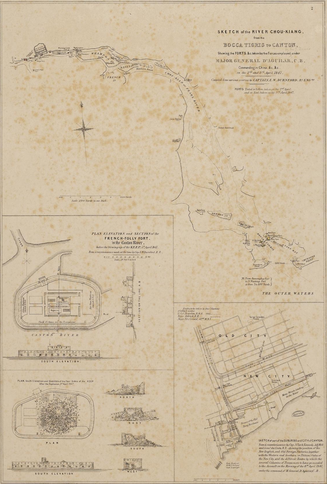
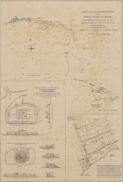
Image: Pearl River sketch
Size of this preview: 405 × 599 pixels. Other resolutions: 162 × 240 pixels | 1,131 × 1,672 pixels.
Original image (1,131 × 1,672 pixels, file size: 1.14 MB, MIME type: image/jpeg)
Description: Sketch of the River Chou-Kiang (Canton River) from the Bocca Tigris to Canton, showing the forts taken by the forces under Major General D'Aguilar on 2–3 April 1847. Also shown is the French-Folly Fort, the City of Canton, and the destruction of the Keep.
Title: Pearl River sketch
Credit: http://www.sothebys.com/fr/auctions/ecatalogue/2010/travel-atlases-maps-natural-history-l10401/lot.68.html Originally from: Operations in the Canton River in April 1847. London: Henry Graves. 1848.
Author: Compiled from various sources by Captain E. W. Durnford
Usage Terms: Public domain
License: Public domain
Attribution Required?: No
Image usage
The following 2 pages link to this image:

All content from Kiddle encyclopedia articles (including the article images and facts) can be freely used under Attribution-ShareAlike license, unless stated otherwise.