
Image: Peace Line, Belfast - geograph - 1254138
No higher resolution available.
Peace_Line,_Belfast_-_geograph_-_1254138.jpg (640 × 367 pixels, file size: 244 KB, MIME type: image/jpeg)
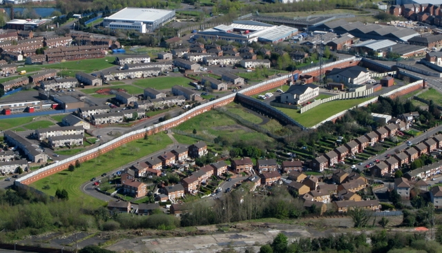
Description: A so-called "Peace Line" in Belfast, separating a Protestant and Catholic neighbourhood from each other. The wall runs the length of the Springmartin Road and is about 18 feet high. The compound at the top of the wall is a police station.
Title: Peace Line, Belfast - geograph - 1254138
Credit: From geograph.org.uk
Author: Ross
Permission: Creative Commons Attribution Share-alike license 2.0
Usage Terms: Creative Commons Attribution-Share Alike 2.0
License: CC BY-SA 2.0
License Link: http://creativecommons.org/licenses/by-sa/2.0
Attribution Required?: Yes
Image usage
The following 3 pages link to this image:

All content from Kiddle encyclopedia articles (including the article images and facts) can be freely used under Attribution-ShareAlike license, unless stated otherwise.